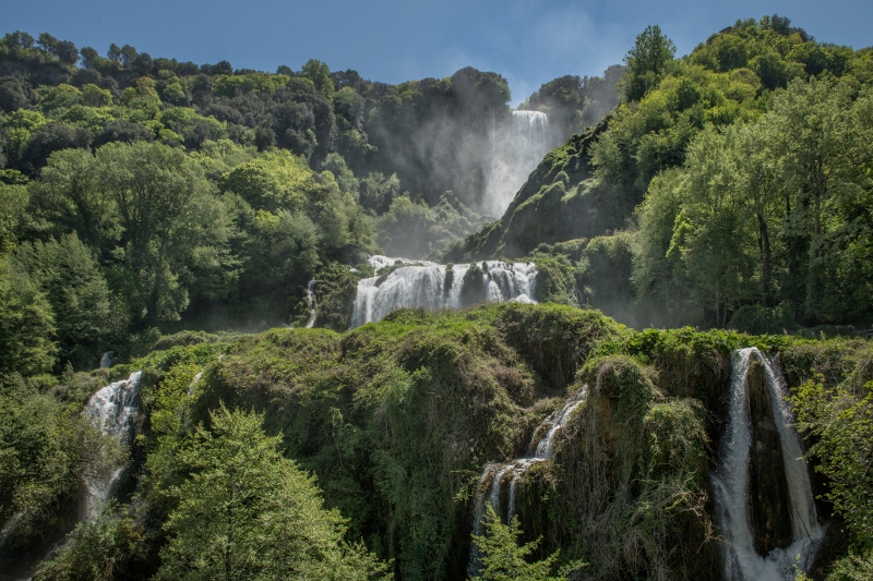
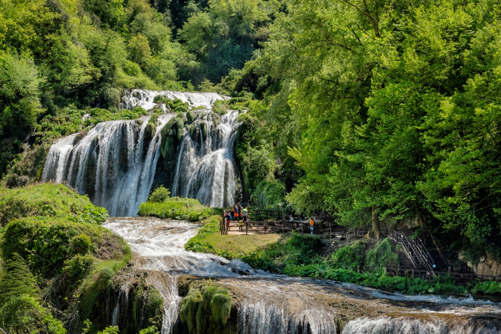
You will be greeted by lush vegetation and a landscape characterised by natural caves and belvederes, where you can enjoy breathtaking views.
The first four trails are included in the park ticket, while the last two have free access. In order to enjoy the walks in peace, closed sports shoes or better trekking shoes and a waterproof jacket are recommended for standing in front of the water jets.
Trail no. 1 "The ancient passage"
| Distance | 1 km |
| Difference in level | 150 m |
| Difficulty | Difficult |
| Duration | 35 min |
| Accessibility | limited (not suitable for buggies or people with walking difficulties) |
Starting point: The path can be taken from either the Lower Belvedere (Piazza Velino) or the Upper Belvedere (Specola Entrance)
Starting from Piazza Velino, at the Lower Belvedere, 600 steps lead you to the highest point of the waterfall. Along the way you can admire natural caves, a tunnel will lead you to the Balcony of the Lovers, from here you only have to stretch out your arm to touch the free-falling waters. The balcony can only be visited by reservation. When you reach the top, at the edge of the Upper Belvedere, you will see the Specola, a small viewing tower erected in 1781 by Pope Pius VI. From here you can observe the Marmore rainbow spectacle, visible when there are special atmospheric conditions.
The path has two rest areas with benches and tables.
Path no. 2 "Ring of the Nymph"
| Distance | 330 m |
| Difference in level | 30 m |
| Difficulty | Easy |
| Duration | 15 min |
| Accessibility | limited (not suitable for buggies or people with walking difficulties) |
Starting point: Piazzale del Centro di Educazione Ambientale (Environmental Education Centre), located inside the excursion area in the lower Belvedere. After crossing the large tree-lined forecourt next to the Environmental Education Centre and walking along a short level stretch, you will come to the sign indicating the start of the itinerary.
This is the path closest to the waterfall, simple and short, but wet in several places. In the first section, one climbs ladders and wooden bridges. From here the view opens up with a small but powerful waterfall - the so-called cascatella - hidden among the vegetation. Further stairs lead you to another short dirt path that lies between the small waterfall and the second drop, one of the most impressive. From this point, the path begins to descend and, by means of a series of steps and dirt tracks, you retrace the route in parallel until you return to the starting point.
Trail n. 3 "The meeting of the waters’’
| Distance | 200 m |
| Difference in level | 20 m |
| Difficulty | Easy |
| Duration | 10 min |
| Accessibility | limited (not suitable for buggies or people with walking difficulties) |
Starting point: Area of the Environmental Education Centre, located within the hiking area in the Lower Belvedere
This path, a short walk, will lead you via wooden steps and bridges to the Nera River at the lower part of the waterfall. From the balconies along the way, you can admire the gorges and rapids of the river, between rock walls eroded by water and lush vegetation, favoured by the habitat rich in oxygen and water vapour generated by the precipitation of water on the steps.
Trail n. 4 ‘’The Majesty’’
| Distance | 520 m |
| Difference in level | 80 m |
| Difficulty | Easy |
| Duration | 20 min the first terrace; 30 min the second |
| Accessibility | limited (not suitable for buggies or people with walking difficulties) |
Starting point: to reach the starting point it is necessary to cross the Valnerina state road at the Byron entrance and reach the "Pennarossa" entrance
This is the only path that allows a complete view of the three jumps.
After a short climb, with stone and concrete steps, the path branches off into two viewpoints, a lower one, the lower Pennarossa Belvedere, and a higher one, the upper Pennarossa Belvedere; both overlook the frontal view of the waterfall. From the upper one, if you still want to walk, you can reach the upper part of Monte Pennarossa through a wood. From here one arrives at the Battery Park near the village of Collestatte.
Trail No. 5 "The cliff and the man"
| Distance | 770 m |
| Difference in level | nil |
| Difficulty | Easy |
| Duration | 15 min |
| Accessibility | accessible to people with motor difficulties |
Starting point: at Campacci di Marmore (Upper Belvedere of the Waterfall), in the immediate vicinity of the ticket office
This is a flat route that runs along the edge of the Marmore cliff, offering suggestive views of the Valnerina valley. Wide lanes interspersed with patches of woodland lead to an industrial archaeology park, which houses artefacts - including loading tanks and models of Kaplan and Francis turbines - from the Galleto and Narni hydroelectric power stations.
Trail no. 6 "The Wise Oaks
| Distance | 1600 m |
| Difference in level | 160 m |
| Difficulty | Difficult |
| Duration | 40 minutes going up, 25 minutes going down |
| Accessibility | very limited (not suitable for buggies or people with mobility difficulties) |
tarting point: You can start the trail from either the Lower Belvedere or the Upper Belvedere
This path is suitable for experienced hikers, as it is uneven and steep in places. Approaching from the Lower Belvedere, the path is level, and then begins to climb abruptly. Although there are no vantage points on the waterfall, you arrive in a fascinating holm oak forest.







.jpg/e9571273-0e35-1ff2-0713-76c7fd4e3cc5?width=456)


