


.jpg/e9571273-0e35-1ff2-0713-76c7fd4e3cc5?width=456)

Marching through nature and spirit, travelling through an open-air museum of places, artistic treasures and landscapes.
The path of the Via Lauretana - The path of the Via Lauretana
In cammino Walking paths
Walking paths
The via Lauretana
Technical details of the route
Sections of the path

The first stage is about 13 km long, taking just under 4 hours to walk. The route is simple and accessible to everyone. The lack of significant elevation changes makes it an enjoyable stroll in nature.
Show all
The most challenging stage of the entire route, stretching 29 km with an elevation gain nearing 900 meters. Suitable for experienced hikers, it offers the chance to visit the charming town of Spello, hermitages surrounded by nature, and to walk through forests and highland pastures of the Colfiorito plateau, while enjoying stunning views.
Show all
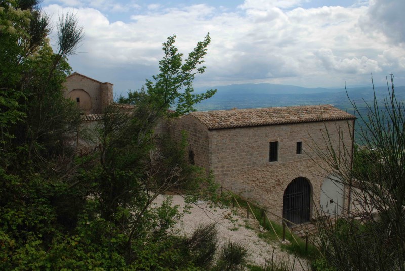
Stage 1 - Assisi to Spello
Technical details of the section
Travel time
Length
12, 6 Km
Difficulty
Easy, suitable for everyone
Height difference graph
-
Positive elevation : + 210 m
-
Negative elevation : - 243 m
Last updated on:
14 gen 2025
Difficulties along the route
Pay attention to the trail, as it’s not always clearly marked. Restoration works are underway to install wooden trail markers and informational totems for better orientation.
Photos
Notes on technical features
Surface: Dirt road
Signage: Wooden trail markers and totems with detailed information about the route, enriched with historical and cultural insights about the area.
Description
The first stage is about 13 km long, taking just under 4 hours to walk. The route is simple and accessible to everyone. The lack of significant elevation changes makes it an enjoyable stroll in nature.
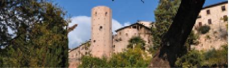
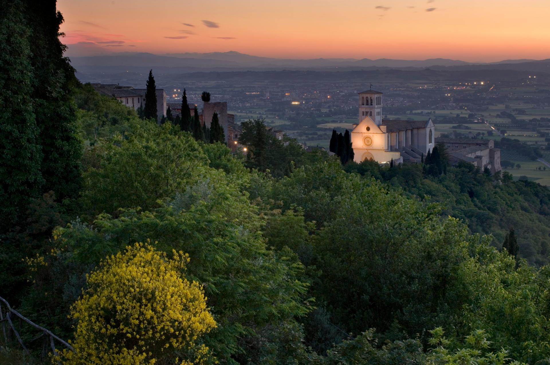
The itinerary begins in the town of Assisi, starting at the Basilica of St. Francis. Passing through the historic center, it leads to the Basilica di Santa Chiara (Basilica of St. Clare), then to Porta Nuova, from where the town is left behind.
Located in the heart of the UNESCO World Heritage site of Assisi, the route offers unmissable landmarks, including the two Basilicas (St. Francis and St. Clare), the Cathedral of San Rufino, and, in the central Piazza del Comune, the Palazzo dei Priori (Palace of the Priors), the Palazzo del Capitano del Popolo (Captain of the People’s Palace), and the Temple of Minerva.
Leaving the town via Porta Nuova, the route follows Provincial Road 147 of San Benedetto.
A 3 km detour allows visitors to reach the Abbey of San Benedetto al Subasio.
The main path continues over approximately 10 km, taking about 3 hours, with a maximum ascent of 210 meters.The trail provides stunning views of the slopes of Mount Subasio, surrounded by coppice woods and olive groves. Along the way, it alternates between paved and dirt roads.
It follows Via Borghettaccio and Via Fonte l’Abate. At the junction with Via Fosso di San Bernardo, the path takes the dirt road towards Via Renaro, merging into Via degli Ulivi.
The final stretch, about 3 km long, skirts Mount Subasio and leads to Spello. The picturesque village is entered through Porta Montanara.
Before departing, consult detailed information available on the official website and app for the Via Lauretana pilgrimage routes: https://camminilauretani.eu.
Show all
Show less
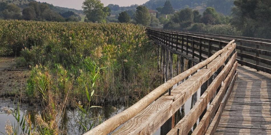
Stage 4 - Spello to Colfiorito
Technical details of the section
Travel time
Length
28,5 Km
Degree of difficulty
hard
Height difference graph
- Positive height difference : + 873 m
- Negative height difference : - 397 m
Last updated on:
14 gen 2025
Difficulties along the route
Pay attention to the trail, as it’s not always clearly marked. Restoration works are underway to install wooden trail markers and informational totems for better orientation.
Photos
.jpg/706bdadf-89af-161c-e7a5-5de8de80a934 )
Notes on technical features
Surface: Dirt road.
Signage: Wooden trail markers and totems with detailed information about the route, enriched with historical and cultural insights about the area.
Description
The most challenging stage of the entire route, stretching 29 km with an elevation gain nearing 900 meters. Suitable for experienced hikers, it offers the chance to visit the charming town of Spello, hermitages surrounded by nature, and to walk through forests and highland pastures of the Colfiorito plateau, while enjoying stunning views.
The second stage, ideal for experienced hikers, is a demanding route of about 29 km, requiring eight hours of walking and involving an elevation gain of about 900 meters.
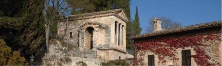
Spello, he starting point, is worth a visit for its Roman and medieval remains and its artistic heritage, such as the Chiesa di Santa Maria Maggiore. Leaving the historic center through Via Brodolini, the route continues on dirt roads and less-traveled trails climbing into the Apennines.
Before beginning the ascent, a detour leads to Foligno, another town worth exploring, where you can visit landmarks like the Cattedrale di San Feliciano.
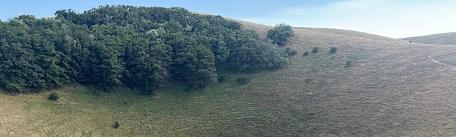
The effort is rewarded with breathtaking views: from the Spoleto Valley to Spello’s hills. The route passes through the quaint village of Treggio and, shortly before Pale, a short detour allows for a visit to the hermitage of Santa Maria di Giacobbe. Continuing, the route traverses cultivated fields, lush forests, and highland pastures, culminating at the Colfiorito Marsh, a treasure trove of biodiversity and natural beauty
Before completing the stage, a stop at the Church of Santa Maria di Plestia is highly recommended. This example of proto-Romanesque architecture straddles the border between Umbria and Marche, with the church building located in Serravalle di Chienti and its churchyard belonging to Foligno.
Before departing, consult detailed information available on the official website and app for the Via Lauretana pilgrimage routes: https://camminilauretani.eu/
Show all
Show less